South Pole Geophysics
I’ve had the great opportunity to join in a collaborative research project, spearheaded by Michelle Koutnik, studying ice flow near South Pole. An overall summary of the project is on Michelle’s website, so here I’ll just summarize the portions with which I’m involved.
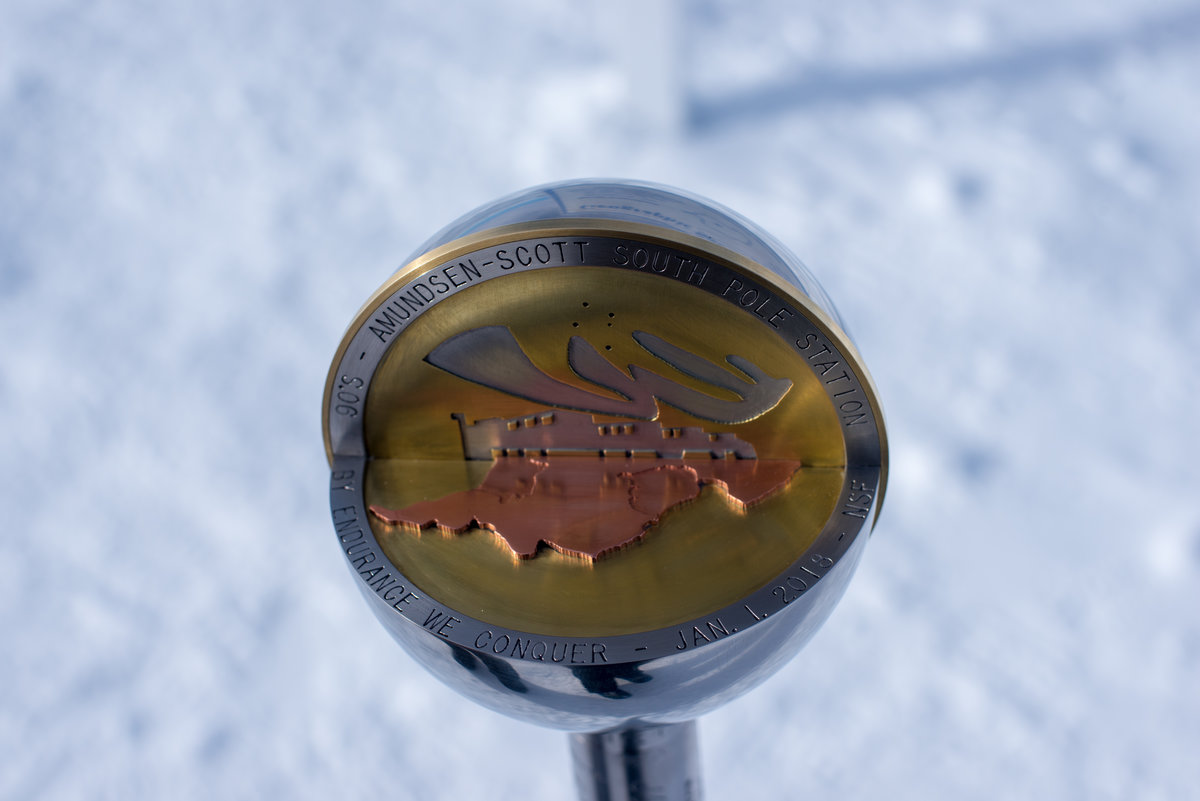
The South Pole Ice Core (SPICEcore) was drilled during 2014-2016 by scientists working around the US, recovering ice from about 1 km from the geographic south pole. There are a lot of benefits to drilling at this site, but one complication is that South Pole is not on an ice divide. The ice at South Pole moves about 10 m/yr; one fun consequence is that South Pole Station and surrounding surface is moving relative to the Pole, so each year on New Years the marker for the Pole gets replaced by a new one, made by the overwintering crew, placed at the new location of the Pole.
The motion of the ice means that the composition of gas, impurities, and water isotopes in SPICEcore is affected by the composition of those components upstream at the time the ice originated as snow. This is both a blessing and a curse; it creates ambiguity in the cause of variations recorded in the core, since some changes in isotopes or temperature may be caused by spatial rather than temporal variation. However, an ice core drilled in stationary ice contains information about only one point in horizontal space, whereas SPICEcore recors information along a line. My involvement is mostly driving a snowmachine around.
The central aim of this project is to characterize ice flow upstream of the site of SPICEcore in both the vertical and horizontal dimensions. In the vertical, this means understanding firn (old snow) compaction, while in the horizontal this means determining where the ice is coming from and how long it took to get to the core site. I’ve mainly been involved with the horizontal portion, though I’ve also done two seasons of shallow radar profiling to look at horizontal variability of layers in the firn.
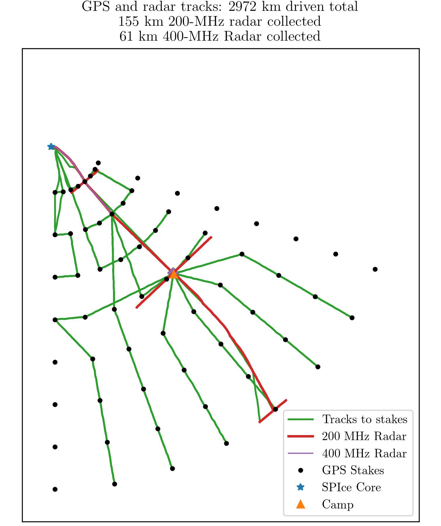
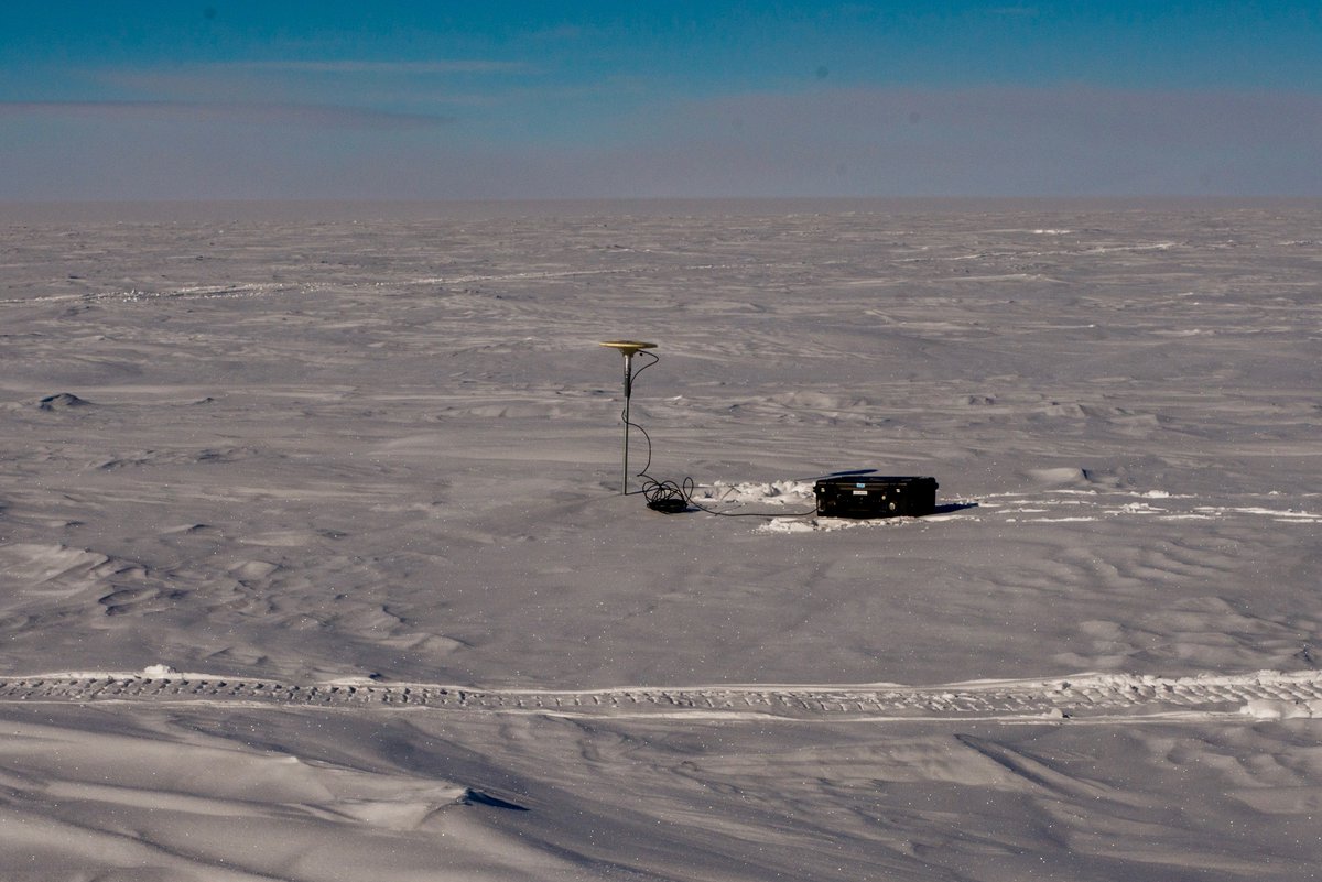
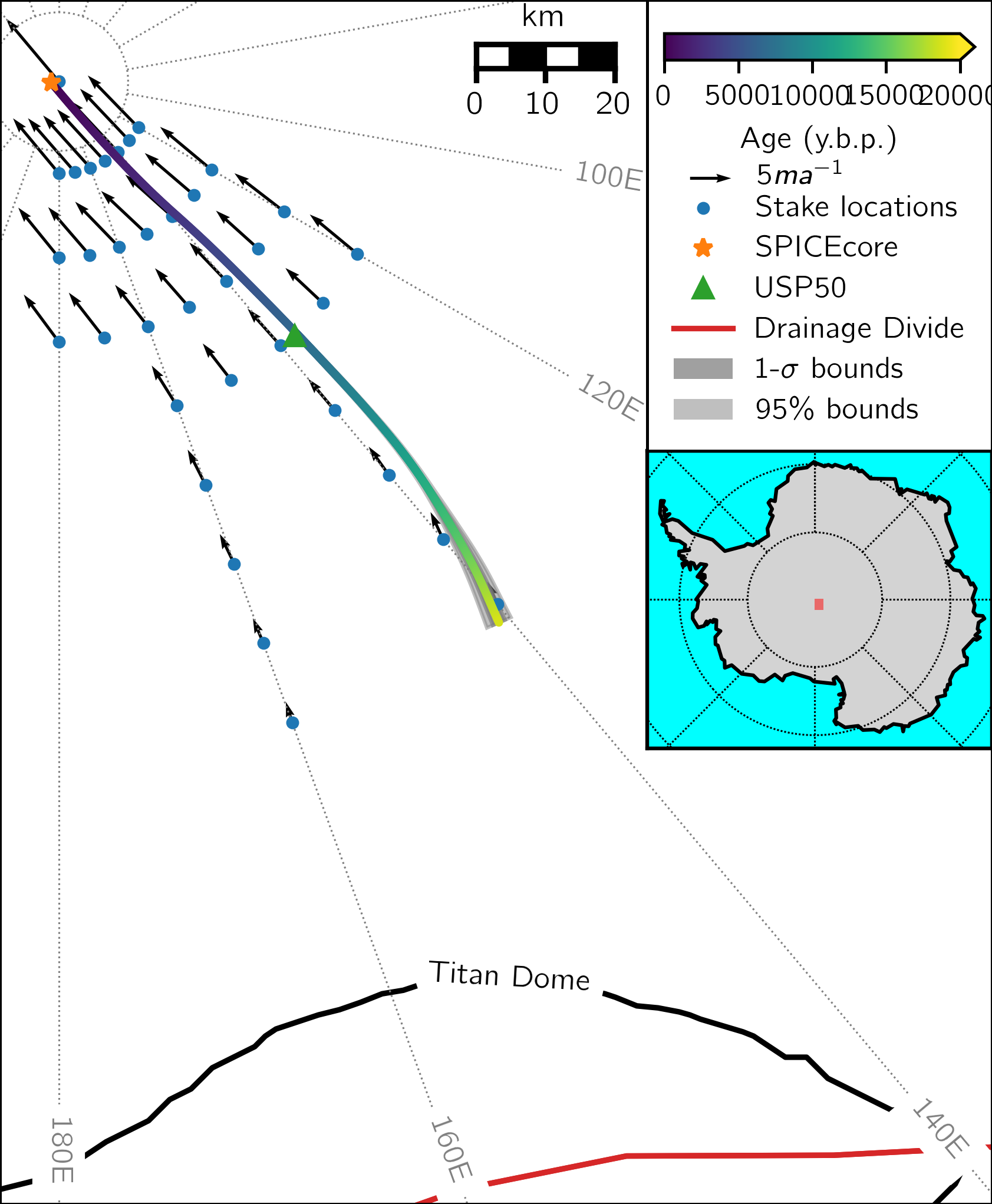
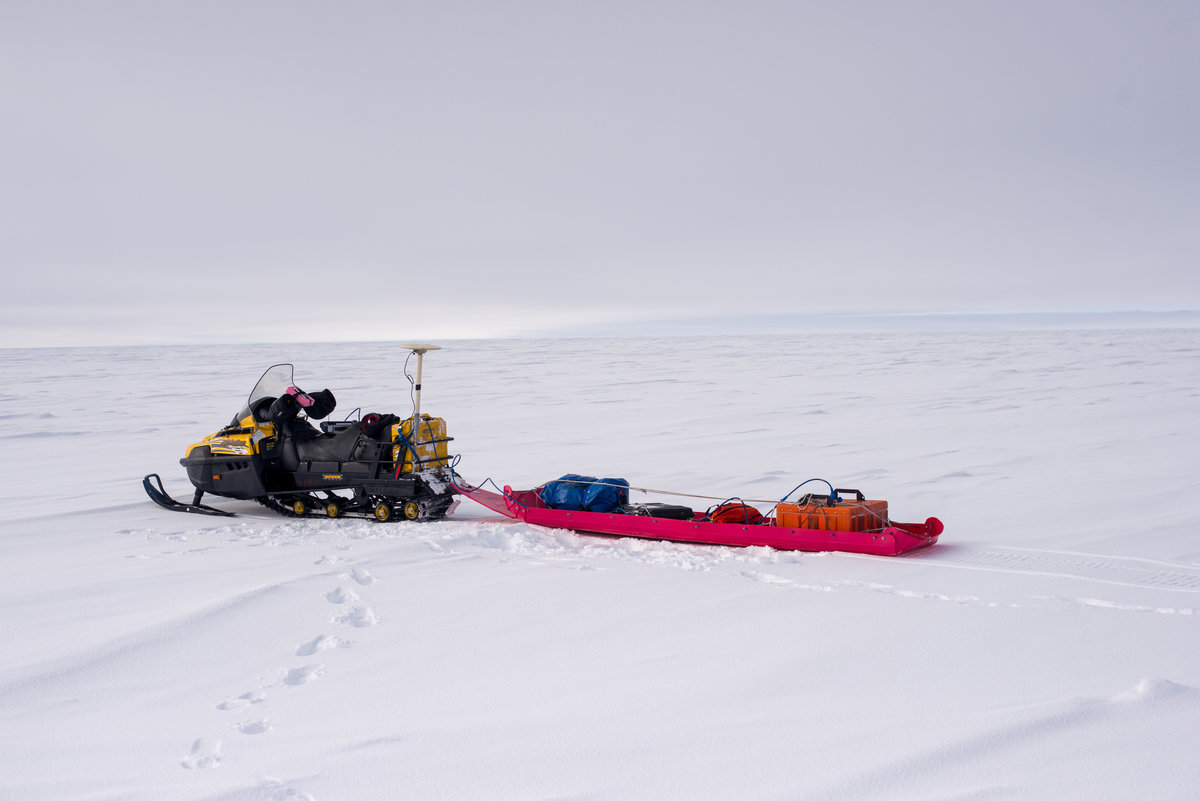
To determine the flowline, and how long the ice takes to flow along that flowline, we used a network of GPS stakes. These days, when we want to find out how ice is moving we use satellite observations (InSAR or optical feature tracking), but the orbits of satellites generally do not go over the poles, so we are unable to use satellite velocities in this region. While GPS also uses satellites, the satellites do not need to be directly overhead, and GPS receivers near South Pole can still see at least twelve satellites and thus obtain an accurate position. By putting out stakes and measuring their displacement over the course of 1-2 years using GPS, we figured out the velocity in the region upstream of South Pole (Figure 2). Using this velocity, it is straightforward to determine the flowline into SPICEcore. My role in this GPS work has mainly been a lot of snowmachining out to place and measure the position of these stakes.
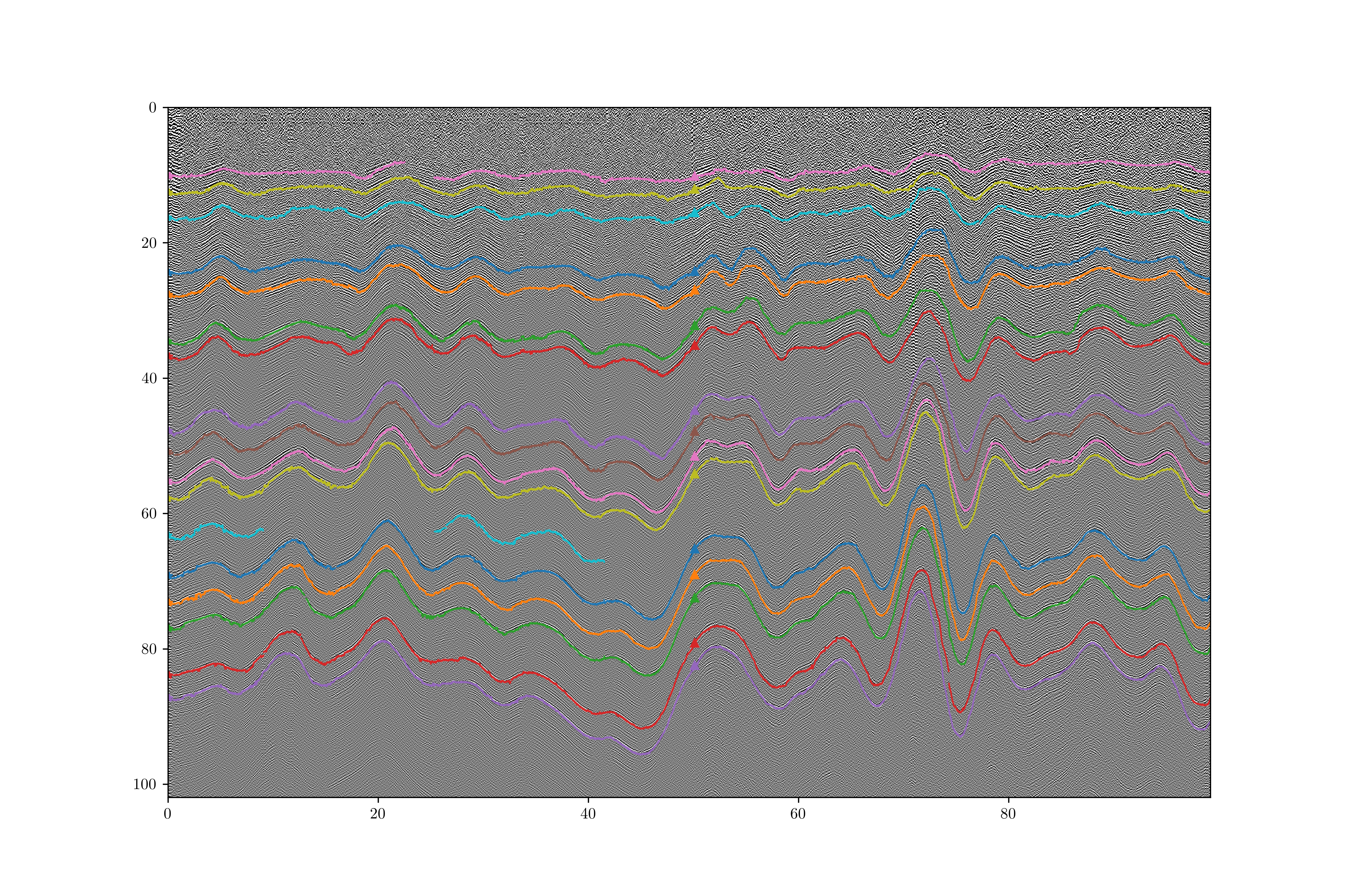
My other main involvement with the project has been with the spatial variation of accumulation (i.e. snowfall). About 20 cm of snow fall each year at South Pole, which compacts into about 9 cm of ice, but the amount of accumulation varies horizontally, probably based on weather patterns and surface topography (imagine snow blowing off hilltops into valleys). In order to figure out how much accumulation takes place at different places upstream of South Pole, we used a ground penetrating radar. This is just a commercial system, usually used by geologists to see through a few meters of soil or rock. However, the frequency travels farther in ice and snow than rock, especially in cold, dry snow, so we can see layers (likely caused by density variations) down to 100 m near South Pole. By dragging this radar around behind a snowmachine, I traced layers to determine how accumulation varies along the lines we profiled (Figure 3).
By comparing the accumulation along the flowline upstream of SPICEcore to the layer thicknesses in SPICEcore, we were able to determine that the flow direction and the pattern of accumulation have been approximately unchanged over the last 10,000 years. During that time, ice flow speeds increased by around 15%. This speedup is not surprising given what we know about the ice thickness history. Ice has gotten thicker in the Antarctic interior since the last glacial because warmer air is able to transport more moisture and thus cause more snow, and ice near the Antarctic margin has thinned due to the warmer temperatures resulting in more melt (mostly from warm water contacting ice shelves). These results were published in Geophysical Research Letters in 2018.
The flow of ice upstream also has implications for interpreting the ice core. T.J. Fudge is leading a paper on these effects, and that will be coming out soon (likely 2019).